Portuairk is the last of the Ardnamurchan crofting townships to be settled, in 1843. Unlike most townships, it was never a settlement, the people who came there being moved from settlements which had been cleared from the 1820s onwards. So, for example, some came from Swordle Corrach, some of whose inhabitants had previously been evicted from Bourblaige and Tornamona in 1828. [1]
The derivation of the name ‘Portuairk’ is open to debate. Donald MacDiarmid, in his ‘Ardnamurchan Place Names’, says that the name may be from the Norse saur (mud) and vik (bay), but prefers the Gaelic port shobhrag, the bay of little primroses, on the grounds that “(a) the bay is not muddy, and (b) the surrounding fields and meadows, especially those lying to the east, abound in primroses and a great variety of beautiful flowers, all in their proper season.” [2] The ‘Annals of the Parish’ states that it may be Gaelic. “Some people pronounce this township Port Uairce as did the population census of 1891. This would come from the aspirated form of suairce meaning pleasant, an unlikely meaning in an area where there are numerous ‘pleasant ports’ and the Gaels were not prone to using romantic names to describe places. The second pronounciation is Port Uaraig or Port Uaric, which appears in some of the Session Books. This would come from the personal name Ulrig, a Norse warrior who made his way down the western seaboard.” [3]
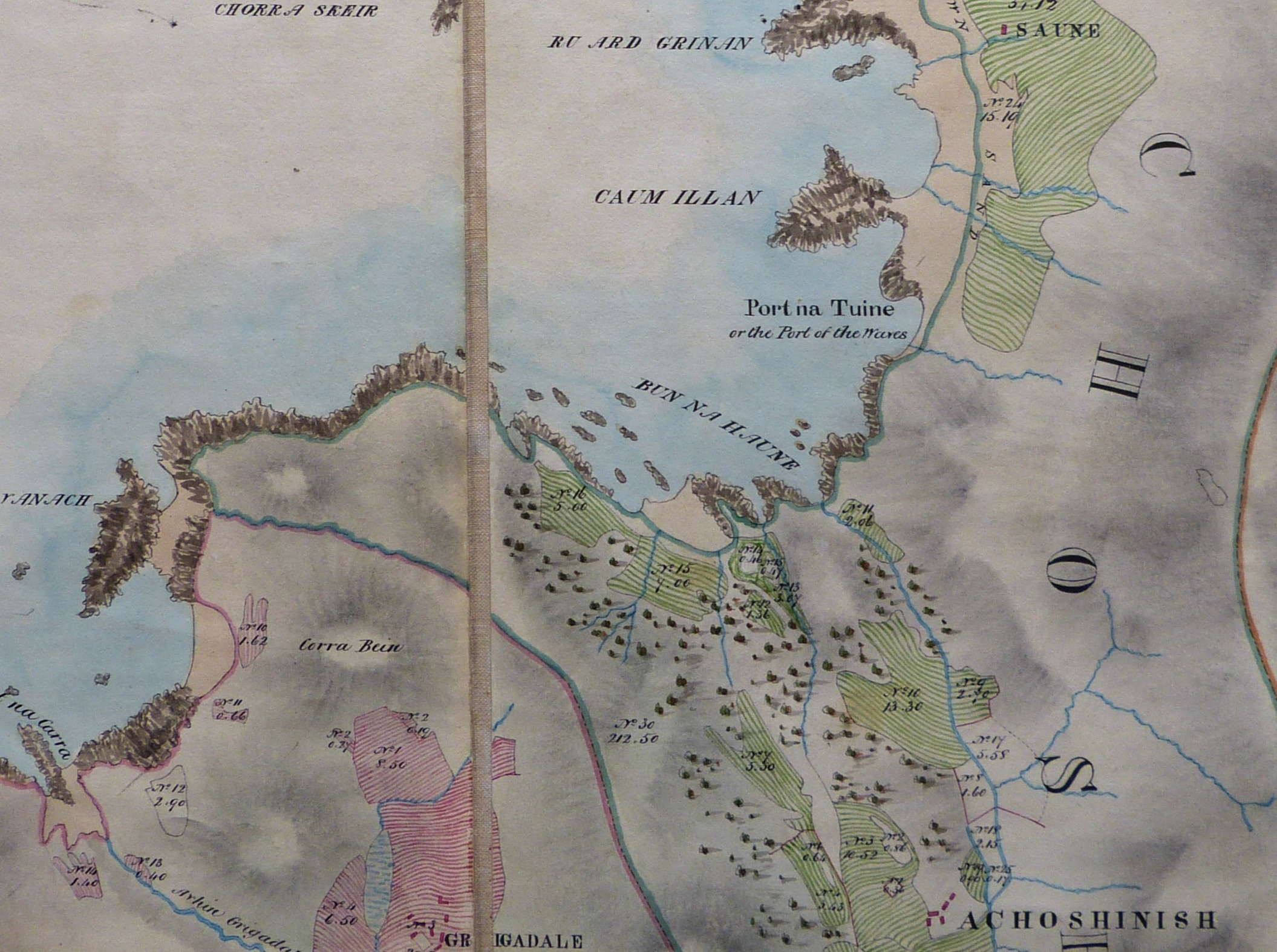
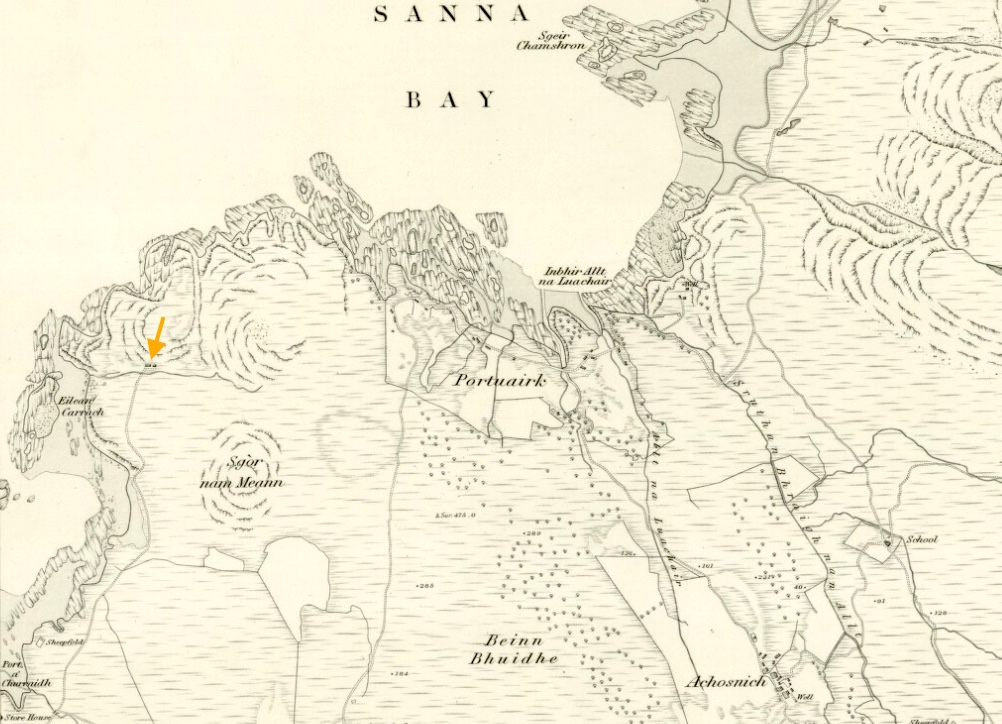
The earliest map showing the Portuairk area clearly is William Bald’s map of 1806, [4], though Bald does not label the place ‘Portuairk’. The site now occupied by the village was part of the Achosnich settlement, as was ‘Saune’ (Sanna). The fields of Portuairk are shown as being worked, but there are no houses marked, so presumably the people who had those fields lived in Achosnich.
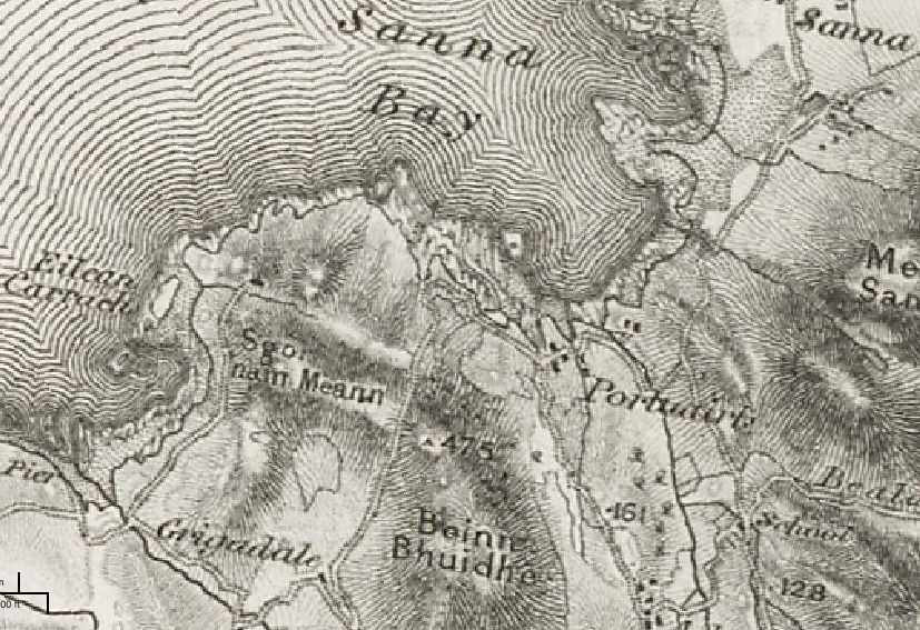
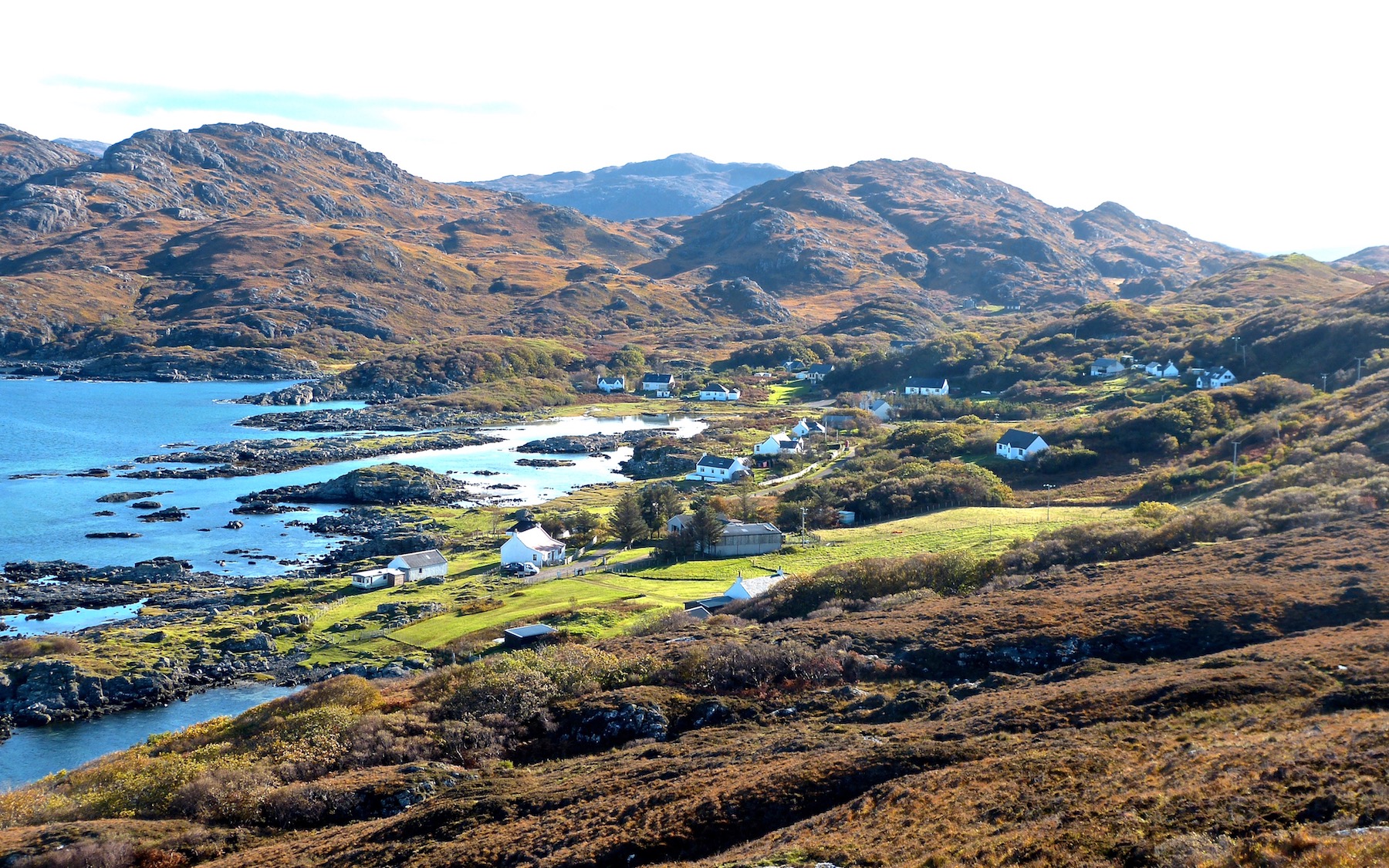
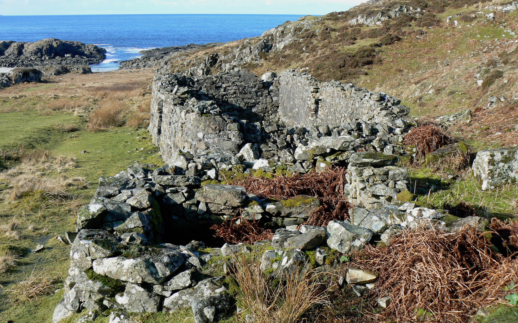
By 1856, when the Ordnance Survey’s First Series map of Coll was surveyed, the beginnings of a settlement can be seen, with six buildings marked, four at the eastern end of what is now Portuairk close to the bay called Port Mackie, and two shown on the Sanna side of the Sruthan Bhraigh nan Allt, buildings whose ruins are still visible today. Their occupants were unwilling arrivals, families who had been cleared from further to the east, from places like Kilmory and the Swordles. Among those who had, by this time, settled in the township were the MacColls. [1]
Why they settled around Port Mackie rather than in what is the main part of Portuairk today is open to speculation, but Port Mackie is extremely well sheltered, has a small burn running through it, and also has an abundance of rushes which would have been used for thatching the small, temporary houses the immigrants threw up when first they arrived.
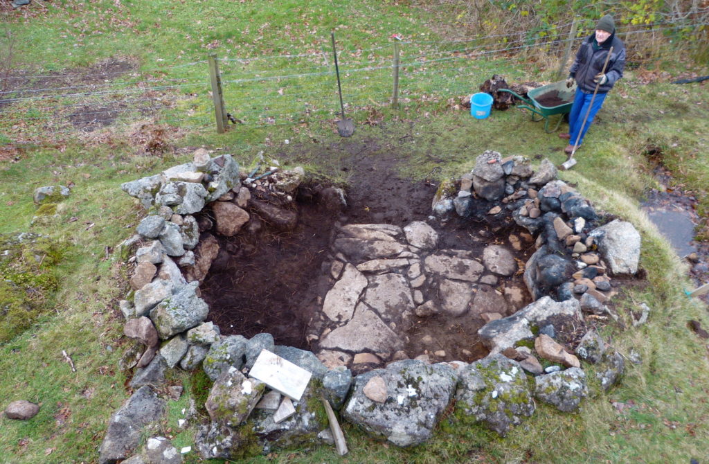
In 2013 members of AHHA excavated what looked like a large shieling hut at Port Mackie, a building which may well have been thrown up by Portuairk’s 1853 arrivals.
By 1872, when the first 6″ map was surveyed by the Ordnance Survey, some twenty-one buildings existed in Portuairk, and the township was taking on its present-day arrangement, with houses scattered along the waterfront. The head dyke, the stone wall that separates croft land from the common grazings, had been built, but the area bounded by it contained few walls, which is puzzling as the individual crofts were probably, by that time, well established.
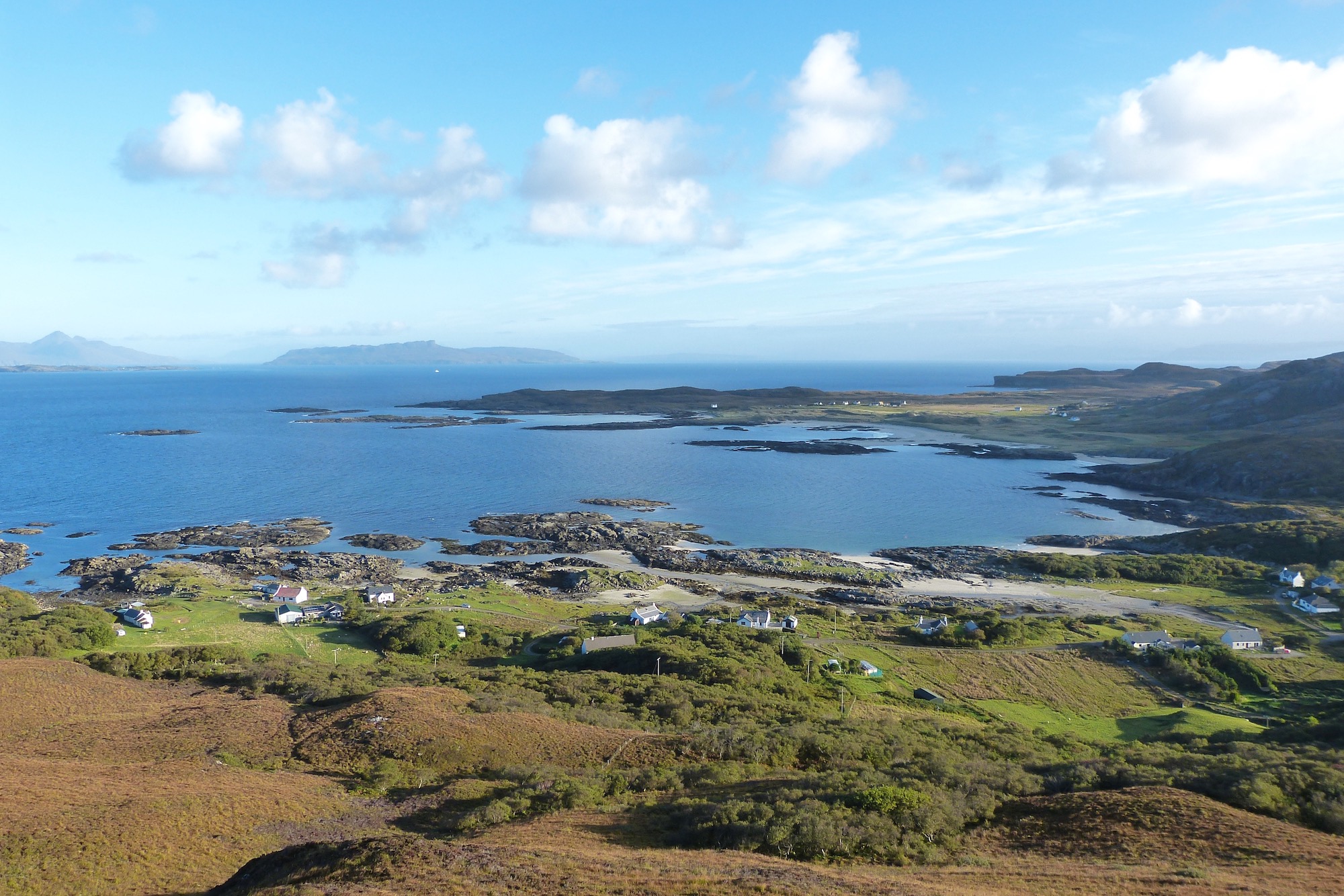
Portuairk was connected to neighbouring townships by three tracks. One followed the line of the present road to Achosnich; an eastern track led to Sanna, with a short spur which connected to the small settlement on the other side of Sruthan Bhraigh nan Allt; and a western track to run south to Grigadale.
Although the house at Bay MacNeil, above -marked with an orange arrow on the 1872 map – had existed before 1856, it was connected not to Portuairk but south to a place called the Store House on the present Achosnich-Lighthouse road near Carraig. This is logical: the house was on land originally part of the Grigadale settlement.
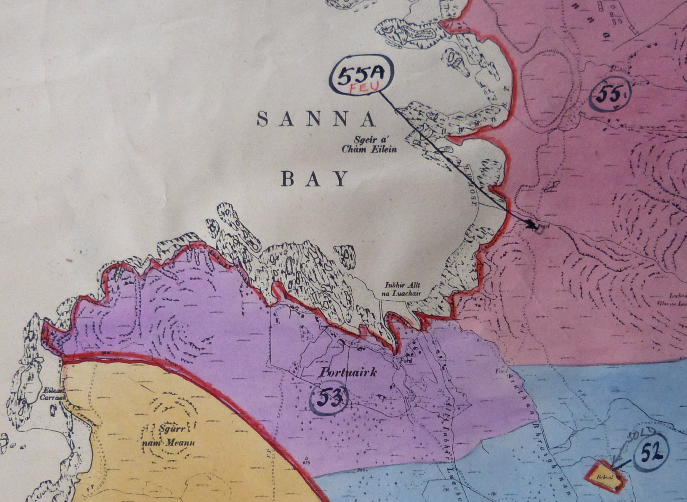
When Ardnamurchan Estate was divided up in 1948 and various lots sold to private buyers, the Achosnich lands were broken up, with Portuairk and Sanna sold separately, Portuairk as Lot 53. [4] [1] Alastair MacColl, personal communication.
[2] Ardnamurchan Place Names – Donald MacDiarmid. [3] ‘Ardnamurchan, Annals of the Parish’, ISBN 0-9515895-0-41981, 1981. [4] Courtesy Donald Houston of Ardnamurchan Estate.