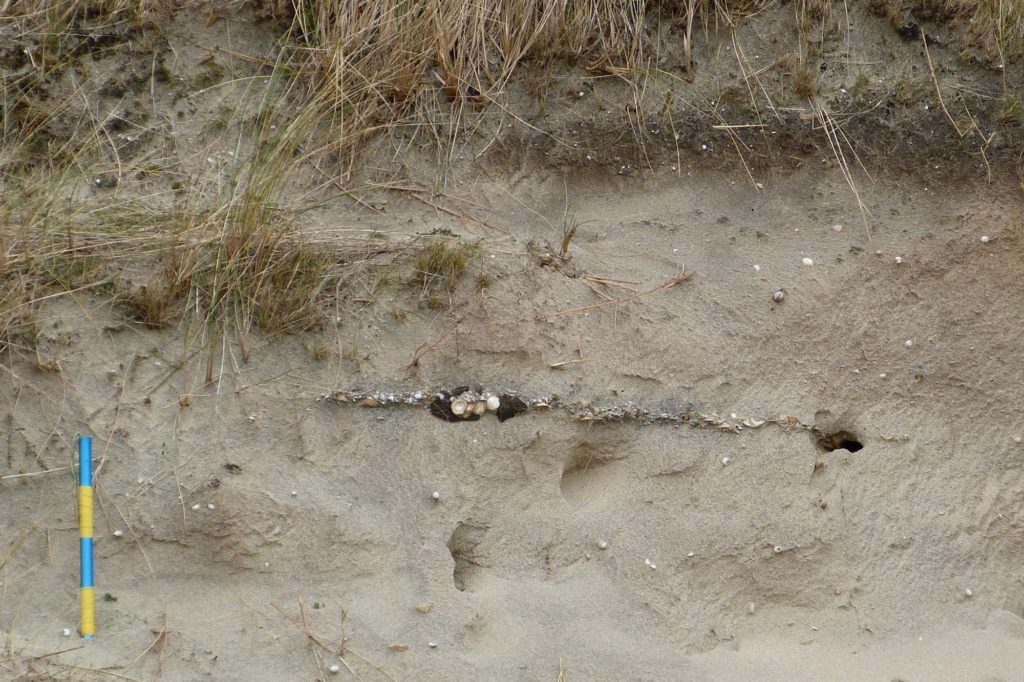
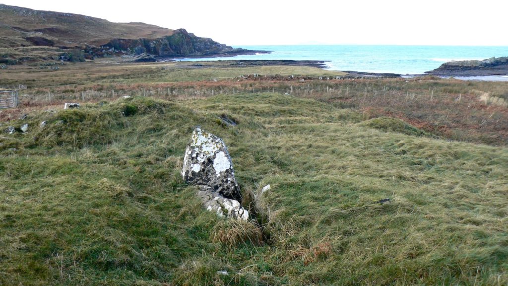
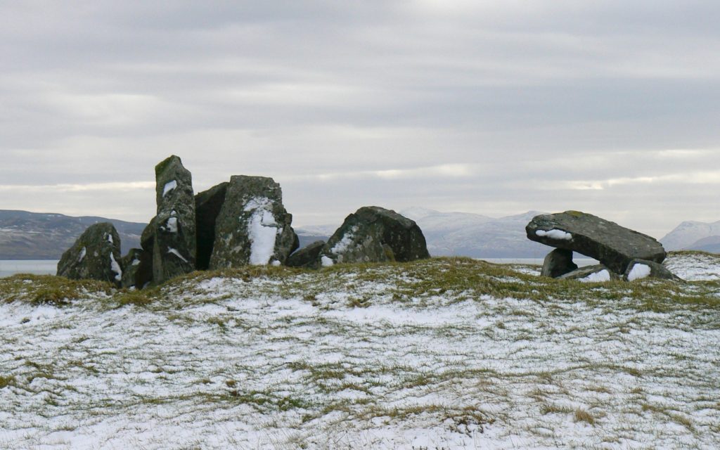
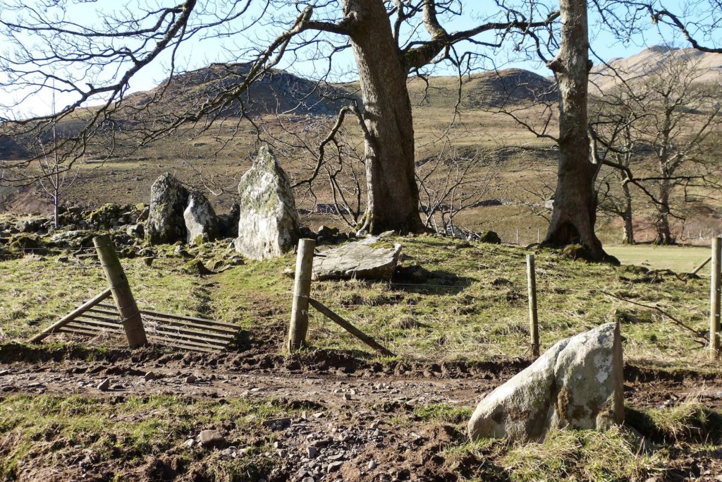
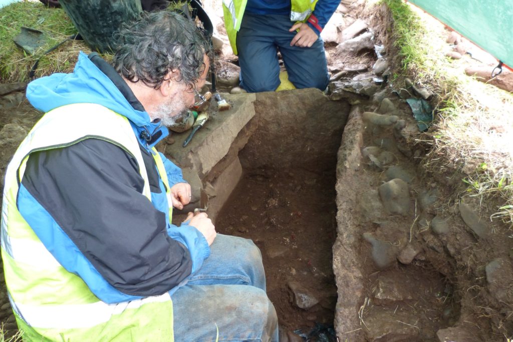
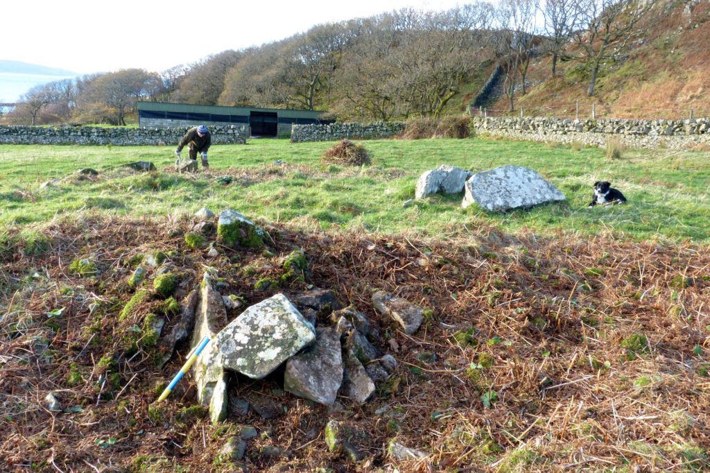
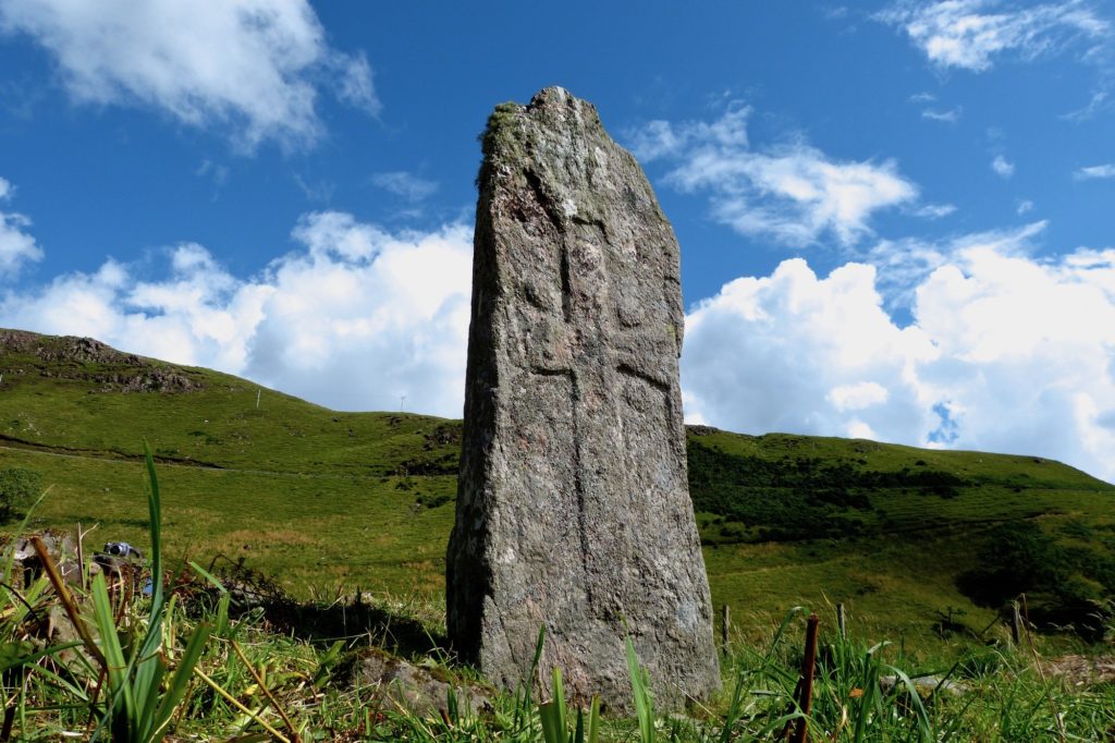
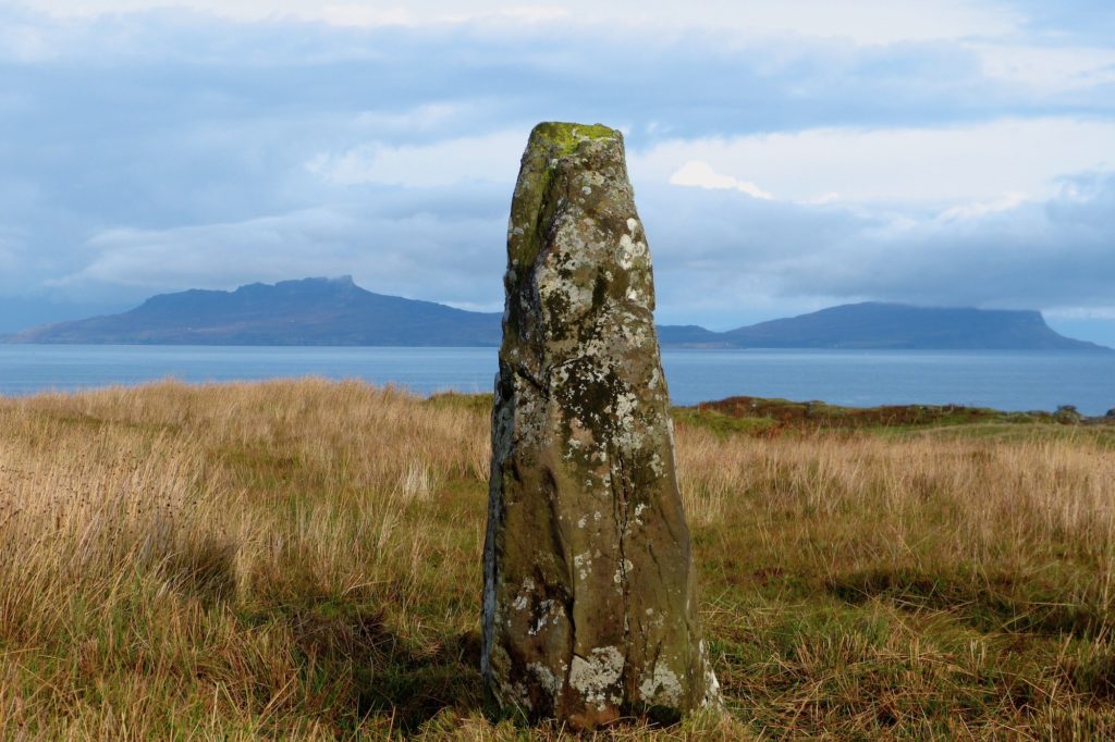
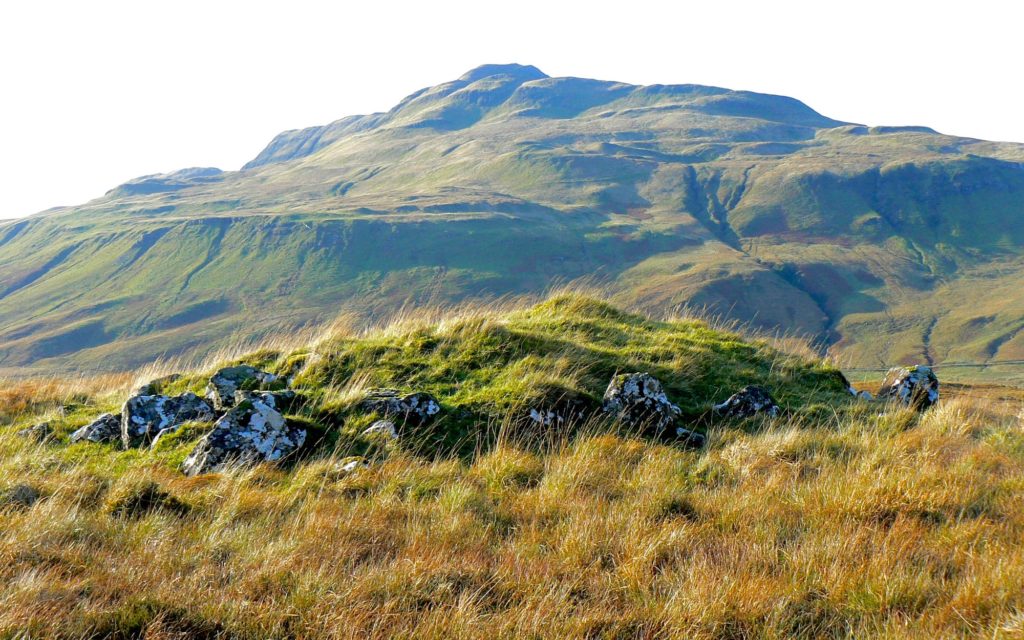
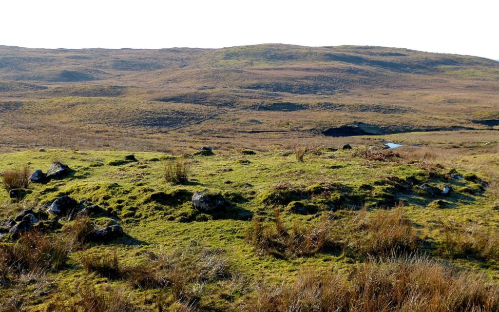
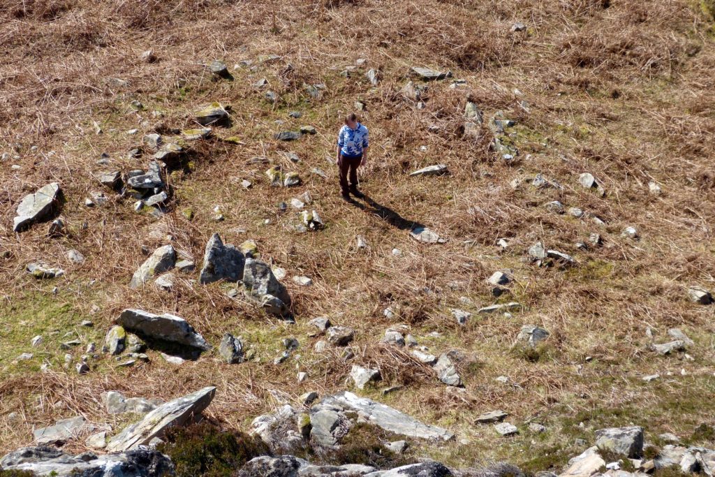
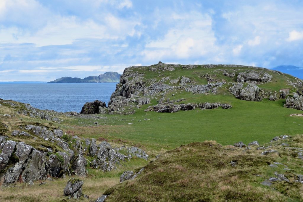
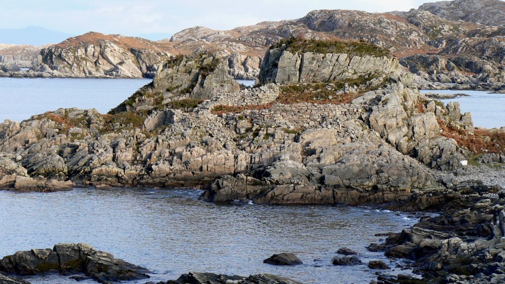
MESOLITHIC Genetic evidence suggests that the first humans to arrive in western Scotland came from Ireland about 9,000 years ago. Their culture was Mesolithic and they were nomadic, moving up the coast in small groups, living in caves or simple shelters but never staying long in one place. If anyone came before them the remains of their Palaeolithic settlements would have been destroyed by the ice sheet which covered much of Scotland until about 10,000 years ago. As the ice melted the landscape left behind resembled today’s open, treeless tundra, the boggy home of mammoth and woolly rhinoceros. As conditions warmed, birch, juniper and willow began to thrive. Around 8,500 years ago, these trees gave way to hazel, pine and oak which were inhabited by elk, wild cattle, red deer, wolf, bear, lynx and wild boar. Little wonder that the early human explorers stuck to the coastlines, particularly to islands such as Rum, Canna, and Eigg, but evidence for their settlement is, in most places, rare. When the glaciers melted sea level rose, but after the weight of ice had gone, the land bobbed up, so sea level at that time was about 10m above present, so it is along this contour that most Mesolithic sites occur. All the evidence suggests that they had boats – how else could they have crossed from Ireland? But the pioneer groups which reached Scotland were were very small in number, perhaps one person for every twenty square miles, yet genetic research has suggested that 75% of today’s Scots can trace their descent back to these first settlers. Risga Middens: A large assemblage of Mesolithic material was excavated, starting in 1920, from a midden on Risga, an island in Loch Sunart just to the south of Glenborrodale Castle – seen at centre of this picture. The deposit, which was 0.3m thick, was found at about 10m above present sea level, at the back of a Mesolithic beach. The midden contained implements made of stone, bone and antler, including mattocks, harpoons and limpet-hammers, together with quartz, flint and bloodstone tools and thousands of worked and waste flakes. It also contained mollusc shells, fish-bones, crustacean remains and the bones of seabirds and mammals. A number of hearths and foundation slots were also found. The latter may have been the foundation slots of small tents or huts, but are more likely to be for wind-breaks. The island, which is only 12 ha (30 acres) in size, is unlikely to have been occupied all the year round, but it must have been an important camp and working-site which was visited regularly. Compared to other sites on the west coast, the Risga finds date from late in the sequence of Mesolithic activity. Sanna Middens: Mesolithic flint-work, a flint barbed-and-tanged arrowhead, flint knives or scrapers, two stone axeheads, and borers were found in midden deposits amongst the dunes at Sanna and are now in the University Museum of Archaeology and Ethnology, Cambridge. The above picture shows a small midden deposit, found recently by AHHA member Ricky Clark. Microliths: Microliths have been found at several sites on Ardnamurchan, at Fascadale, Camas nan Geall and Sanna. NEOLITHIC The nomadic existence of the Mesolithic people gave way to a more settled lifestyle in the Neolithic, starting around 6,000 years ago. The settlers cleared forest, built permanent settlements, and sowed crops rather than relying on hunting and gathering. DNA suggest that the number of immigrants was quite small, somewhere around 20% of the total population, so it was the idea of farming which spread, taking about 2,000 years to reach all parts of Briain.es Like the early Mesolithic nomads, the Neolithic peoples kept primarily to coastal areas. Neolithic houses were mostly made of timber, and people only used stone, as at Skara Brae, Orkney, when wood was unavailable. As a result, the remains of Neolithic houses are scarce. More visible are their burial mounds, cairns, chambered tombs, barrows, passage graves and other burial structures, with people interred as some form of religious observance, suggesting a belief in an afterlife. Other stone structures associated with both the Neolithic and the Bronze Age are stone circles and standing stones. Cladh Aindreis: Cladh Andreis, a chambered cairn at Swordle which is a scheduled monument, has been investigated by the Ardnamurchan Transitions team over several years. From their work, we know the site dates back to about 3700 BC. Full details of their findings are at their site, here. Greadal Fhinn: Greadal Fhinn, a Neolithic chambered cairn containing two graves, a passage grave and a cist grave, stands on a low knoll on Grianan croft in Ormsaigmore. The remains of the cairn are roughly circular, with a diameter of approximately 21-22 metres. The mound may originally have been formed of stones, but these have since been removed, probably to use as building materials and walls, exposing two burial chambers. A full description of this scheduled monument is on this site, here. Camas Nan Geall Chambered Cairn: The remains of this large cairn can be found at the south end of the line of sycamore trees in the flat land by the bay. The tomb is of the Hebridean type, and the site is a scheduled monument. Full details are on this site, here. NEOLITHIC to BRONZE AGE A flint scraper, found by Fred Millwood when he was employed as a forester in the 1980s, and was planting the woodland by Loch Mudle, has been described by Ardnamurchan Transitions archaeologist Olly Harris as, “probably Neolithic or Bronze Age, and more likely the latter.” Olly described an arrowhead, also found by Fred, as, “a barbed and tanged arrowhead which dates to the Early Bronze Age, around 4,000 years ago. It’s a lovely piece although one of the tangs is missing, and it looks like the tip might have snapped off – which can happen when they are used!” BRONZE AGE The Bronze Age, from about 4,500 to 4,000 years ago to about 2,500 years ago, is often identified with the Beaker People, named for the distinctive shape of their pottery vessels, often found in graves. At this time, people began using bronze (10% tin and 90% copper) to make tools, ornaments, and weapons. The earliest use of bronze was for spears and axes, usually cast in a mould carved from solid stone. By 3,400 years ago people began to use sand moulds to make socketed spears and axes. With improving techniques, the rich began decorating their bronze implements. By the last phase of the Bronze Age (2,900-2,400 years ago) elaborately decorated tools, jewellery, weapons and pots were being produced. The Beaker folk mixed with the established Neolithic farmers: their beakers have been found in Neolithic tombs. Textile production was also under way by this time. Women wore long woollen skirts and short tunics. The men wore knee-length wrap-around skirts, or kilt-like woollens, as well as tunics, cloaks and one-piece garments. They were clean-shaven, long-haired and wore round woollen hats. The standard farming household consisted of two houses, a main living house and an out-house for cooking and textile production. The dead were cremated and buried in large cemeteries in the early Bronze Age, but these later became smaller and more local. Swordle Chambered Cairn – Cladh Andreis: Following the Neolithic activity at Cladh Andreis, perhaps a thousand or more years later, people returned to the site and dug into the front chamber, placing Beaker pottery inside. They then blocked off and sealed the chambers, ending direct access to the monument. Even this was not the end of the Bronze Age story, however, as just nearby, less than 10m away, another monument was built a few hundred years after the original tomb was sealed. Found by AHHA member Ricky Clark, this is called Ricky’s Cairn. Swordle Chambered Cairn – Ricky’s Cairn: The picture shows Professor John Robb of Cambridge University excavating bones found in Rick’s Cairn at Swordle, dated to around 3700 years ago. The cairn was named after AHHA member Ricky Clark, who found it. It was excavated by the Ardnamurchan Transitions team during their 2014 season, and is described on their site here. Swordle Enclosure: During fieldwalking the Ardnamurchan Transitions team discovered a deposit of cremated bone that had been exposed in a field during ploughing. A small flint tool, called a thumbnail scraper, found with the bone suggested this was probably Bronze Age in date. A later geophysical survey identified a potential circular enclosure immediately next to the cremation and they also excavated the rest of the cremation, which has a radiocarbon date in the Bronze Age, some time around 3,600 years ago, shortly after the burials at Ricky’s Cairn. Erikson’s Cairn: In late 2014, AHHA member Ricky Clark found a chambered cairn a kilometre to the east of Mingary Castle. Its layout is very similar to Greadal Fhinn, though the cairn, the two chambers, and the rocks of which they are formed, are much smaller. The cairn has a diameter of approximately 14m, with the central cist consisting of two remaining upright stones. On the north side, three or perhaps more upright stones form part of the kerb; any other kerb stones are missing. On the east side, a small burial cist (foreground) has been inserted into the cairn. The site includes two possible straight wall structures, and a circle of marsh grass suggesting another structure. Camas nan Geall Standing Stone: Near the beach is a standing stone over 2.3m high. The stone was later engraved with Christian images which may date to the time of the coming of St Columba, after he began his west coast journeys in 563ADa. The carvings include a Latin cross with wedge-shaped side-arms, a central crosslet and large pellets in the angles. At the top is an equal-armed cross above an animal with up-curved tail – perhaps a dog. Branault Standing Stone: A basalt standing stone at Cladh Chatain, Branault, 2.2m high, lies in a hollow between two rock ridges 460m NW of Branault. Close beside it is the stump of the another stone, suggesting they were once a pair. The name ‘Cladh Chatain’ is not now applied to the stone, but is believed locally to apply to the site of a church, whose position, and that of the alleged holy well, is not known. Beinn Bhuidhe Cairn: Near the Estate wind turbine is a ten metre diameter, two metre high cairn which has a ‘kerb’ of large boulders. While the central mound is largely undamaged, a depressed area to the SE suggests it may have been robbed from that side. The cairn is sited to the south of Beinn Bhuidhe with good views to the southwest towards Ben Hiant. Little work has been done on this, so its age is uncertain. This cairn, and the Forestry and Caim cairns (below), show similarities to those excavated by JN Graham Ritchie and Iain Thornber in the Aline valley, Morvern, in the 1970s. These were of similar dimensions and had kerb stones of comparable sizes, and were dated to late Bronze Age. Sanna Middens: Along with the Mesolithic remains mentioned above, sherds of Beaker ware have been found. BRONZE to IRON AGE Beinn nan Losgann Forestry Stone Circle: A circle of stones of 12m diameter stands on a low knoll looking down the valley of the Allt Choire Mhuilinn towards Mingary. Dr Oliver Harris of the University of Leicester has looked at it and believes it to be either a kerb cairn or the circle of a Bronze Age hut. There is no sign of a cist grave within the circle, but this may have been destroyed or lie hidden beneath the soil. Caim Stone Circle: A 9m diameter circle of stones stands on a ledge on a hillside looking across the valley of the Allt Choire Mhuilinn. Very similar to, but smaller than the Beinn nan Losgann Forestry circle, this again may also be either a kerb cairn, though there is no sign of a cist, or the foundations of a hut or roundhouse. Hut Circles: Hut circles in northern Scotland vary in diameter from 5m to over 12m and have in common that they consist of a simple ring-like enclosure delimited by a bank of earth and stones or even boulders. However, there are many different types of ’round house’, from a ‘wigwam’ design, with the rafters of the conical roof supported directly on the ground, to some that had circular walls founded on a bank of earth and faced with wattle panels, while others had roofs supported on internal rings of posts which may also support an upper storey. They occur in groups or alone, and some are located on a slope, presumably for better drainage, and feature a level platform cut into the uphill side with the material spread in a crescentic apron downslope. Inside these houses the space was divided by timber partitions around the periphery, while the central floors were left open to form the communal focus of the house for cooking and eating. The peripheral bays seem to have been floored with timber planks to serve as sleeping or working areas Members of Ardnamurchan History & Heritage Association have found four other structures which may be the stone foundations for Bronze to Iron Age huts. The finest of these, found by Allyson and Andrew Perkins, is at Eilagadale – picture above. They describe it as, “Substantial, with a large number of stones, in places several stones in height, arranged in a continuous circle with a possible stone chamber to the north side. In reasonable state of preservation, it is situated in sheltered position, approx 100 metres from the shore. We presume this is a hut circle, diameter of original hut about 8m but 10m including talus slope. Highland Council’s HER has registered the field workings around the site but not the stone circle.” The other hut circles are near Glendrian caves, to the north of Glen More, and on the ridge above the Basin where the B8007 approaches Camas nan Geall. All have in common that they are large and prominently sited. IRON AGE Around 2,500 years ago bronze began to be replaced by iron for making tools and weapons, iron ore being more easily found and the implements harder, longer lasting, and sharper. With the Iron Age came a wave of settlers from Europe known as the Celts. It is uncertain where the Celts originated, but the first arrivals in Scotland took place around 2,900 years ago. Some Celts were known to paint their bodies with bright colours, so when the Romans invaded Scotland they called the inhabitants they fought ‘Picti’, or ‘painted’. Celtic life was based on a tribal unit headed by chiefs. The tribe might also be an extended family, or clan. They also developed specialised classes of people, such as priests, farmers and tradesmen, their leaders being drawn from an aristocracy made up of the best warriors in the tribe. There were no kings of the Celts as we understand the term. Rather, each group was loyal to a local chief. Iron Age features on Ardnamurchan include stone fortifications, called duns, and crannogs, settlements built in lochs. The Fort at Rubha an Duin Bhain: Rubha an Duin Bhain means the headland of the white fortress. Historic Environment Scotland refers to the site as ‘Burnbank Fort’. It lies on the north coast of Ardnamurchan, due north of Sanna, and forms the western arm of a wide bay. An adjacent sandy beach is separated from the sea by rocks so, although the beach would have been a good pull-up for boats, this could only have been achieved for an hour or so either side of high tide. The remains of the fortress, which is described as a promontory fort, can be found on the western two-thirds of the ridge, which is separated from the eastern end by a deep cleft. The land immediately behind the beach has a machair soil, across which the stripes of lazy beds can be seen, so it was, at one time, worked. The wall survives as a stony bank up to 4m in thickness and up to 1m high. A line of collapsed rocks indicate the position of the wall. The entrance is a narrow gap in the wall just slightly to the west of the centre of the wall. Most of the interior of the fort is occupied by thin, grass-covered soil and bare rock, but immediately to the north of the main wall are two grassy areas which are probably the sites of prehistoric dwellings. Allt Sordail Dun: About a kilometre south of Swordle, buried in the forestry, is a dun sited on the summit of a rocky knoll. Measuring 15.2m by 9.1m internally, the walls have been heavily robbed of their facing stones to provide material for nearby dykes, and a small rectangular enclosure and a modern cairn have been built on top. However, the lowest course of the outer face is still visible in many places, and at one point on the NW a short stretch of the inner face also survives, indicating that the wall had a thickness of at least 2.5m. A considerable quantity of core material remains, standing to an average height of about 0.5m. The position of the entrance is uncertain, but it was probably either on the NNE or SSW. Rubha na h-Uamha Dun: About half way between Ockle and Eilagadale are the exceptionally well-preserved remains of a dun. The dun measures 18.3m by 10.7m within a dry-stone wall, which varies in thickness at the base from about 1.2m to 4.3m. The wall is remarkably well-preserved, particularly on the west, where for a considerable length, the outer face survives to a height of 2.4m in twelve courses and the inner face is only slightly lower. Lochan na Crannaig While the name of the feature has been translated as “the small loch of the pulpit”, the small peninsula in the loch may be a crannog. On it are the footings of a crude wall about 0.5m wide, which abuts on to the waters edge forming a sub-rectangular enclosure roughly 12m by 10m. At the north and east corners are two circular structures roughly 2m in diameter, which are also reduced to the base course. These were probably a sheep enclosure with lambing pens attached.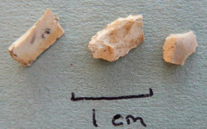 The characteristic sign of a Mesolithic site is a shell midden, a pile of discarded shells, mostly limpet, whelks and periwinkles. Mixed in with these are fish bones, the bones of deer and wild cattle, and some fruits, roots and nuts. Sometimes these stone-aged rubbish dumps lie in front of caves, as at MacArthur’s Cave near Oban, at other times they are at the back of a beach. In amongst them are found man’s earliest tools, made from antler and bone, or small flakes of hard stone – such as these flint microliths found by AHHA member Tim Steel at Fascadale. Flint, which makes the best tools, is rare in this part of Scotland, so hard, local rocks were used, one of which was a bloodstone from Rum.
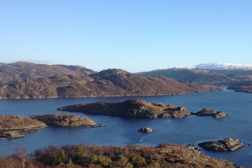
Heritage Ardnamurchan
Celebrating the History & Heritage of the Ardnamurchan Peninsula