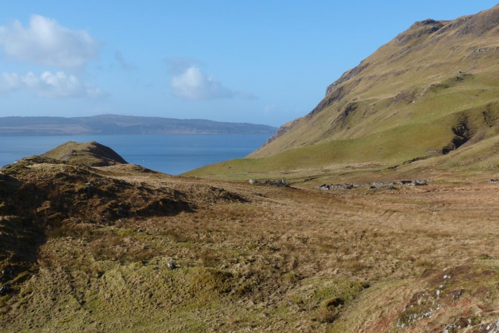
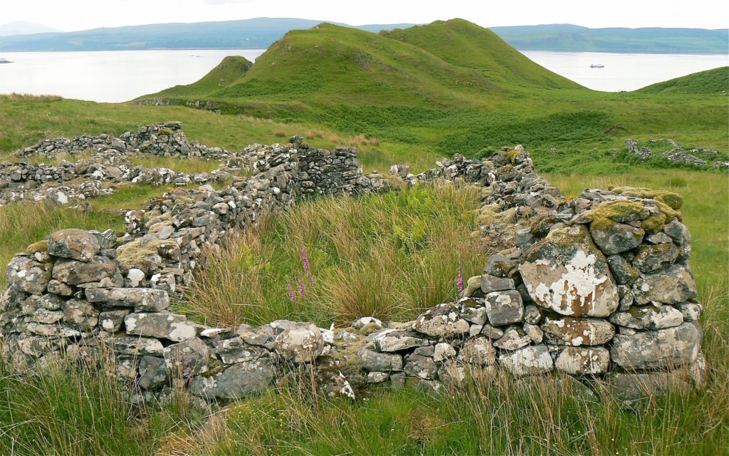
 The ruins of Bourblaige lie in a spectacular site in a wide bowl of land. The lower slopes of Ben Hiant rise steeply to the northwest, providing some shelter. The glen falling away to the southwest, gives views across the Sound of Mull to Morvern and Mull and access down to Loch Sunart. There’s a burn passing through the village, and farming land around it.
The settlement goes back to medieval times and likely much further still. What can be seen today is the remains of a 19th village which came to an abrupt end when ‘cleared’ in 1828 – along with the other villages around the slopes of Ben Hiant – to make a sheep run.
Bourblaige is better preserved than these other villages perhaps because of its geography. There appears to be no re-use of its stone for post clearance buildings or dwellings and it was not used for the central gathering or holding of domestic animals.
It still has the atmosphere of an intact village, but with shells for houses – and frozen in time to 1828. There is a certain stillness there, peaceful for some but sad or even ghostly for others.
Historic Environment Scotland (HES) has scheduled the whole area of the settlement because , “The monument is of national importance for its potential contribution to an understanding of the way of life and the architecture of post-Medieval communities in this area of Scotland. Many of the buildings are well preserved and contain complex architectural information.”
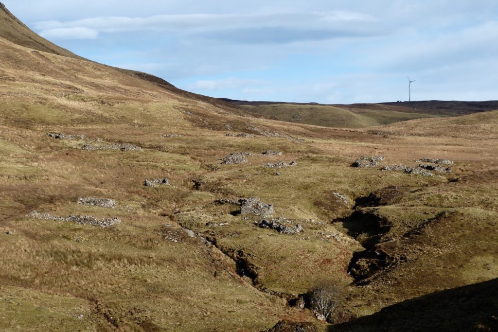
However, the buildings and walls are deteriorating with exposure to the weather and grazing animals.
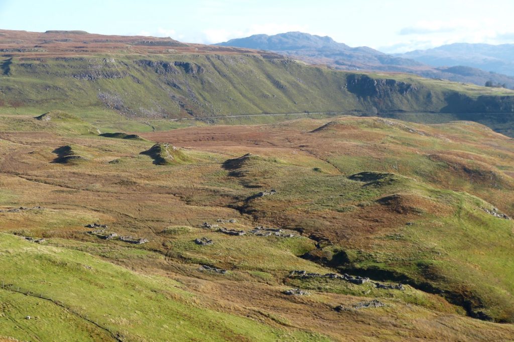
Bourblaige was one of West Ardnamurchan’s larger communities, with a population of 35 in 1737. In his 1807 report to the then Estate owner, Sir James Riddell, Alexander Low described it as, “a very pleasant sheep farm oppressed with too many tenants” This satellite image from Bing Maps gives an idea of its size, and of the extent of the agricultural workings which surround it, while….
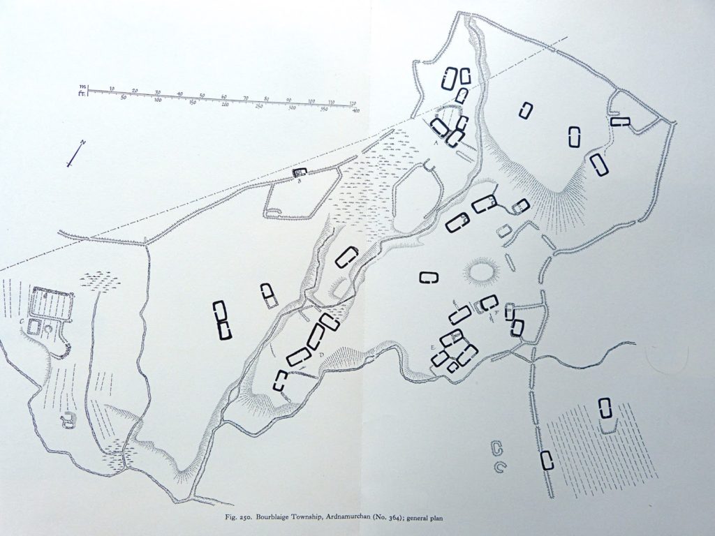
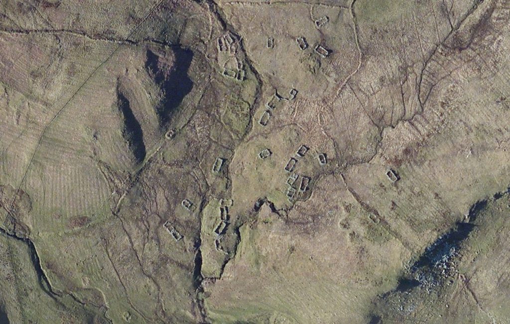
….this map from research carried out for Highland Council gives detail of the field walls and buildings.
According to the HES count, there are about 36 buildings including what may be houses, barns and byres, often associated with small enclosures which may be kail-yards.
Local stories about the cruelty of the Bourblaige clearance and the heartlessness of the Factor (working on behalf of Riddell, the owner, to effect the evictions) are still current. The story is that nothing will grow on this man’s grave……
An account written in 1892 describes the Bourblaige clearances as “….attended with many acts of heartless cruelty on the part of the laird’s representatives. In one case a half-witted woman who flatly refused to flit, was locked up in her cottage, the door being barricaded on the outside by mason-work. She was visited every morning to see if she had arrived at a tractable frame of mind, but for days she held out. It was not until her slender store of food was exhausted that she ceased to argue with the inevitable and decided to capitulate.” Another observer recorded that, “To clear Bourblaige, the laird’s men shot the dogs, and they shot the goats, and they drove away the cows. And then they took the roofs off. It was in the wintertime that they did it. Ploughs were put through the potato pits so that they would spoil in the frost. And the people walked to Swordle [on the north coast] through showers of snow.”
Some people living locally can trace their families to Bourblaige and subsequently to Swordle, which was also cleared in a further round of evictions 27 years later. Many folk emigrated. Greg Towner, of Australia has undertaken comprehensive research of the history of the Bourblaige families at the time of the Clearances. Click here to take a look.
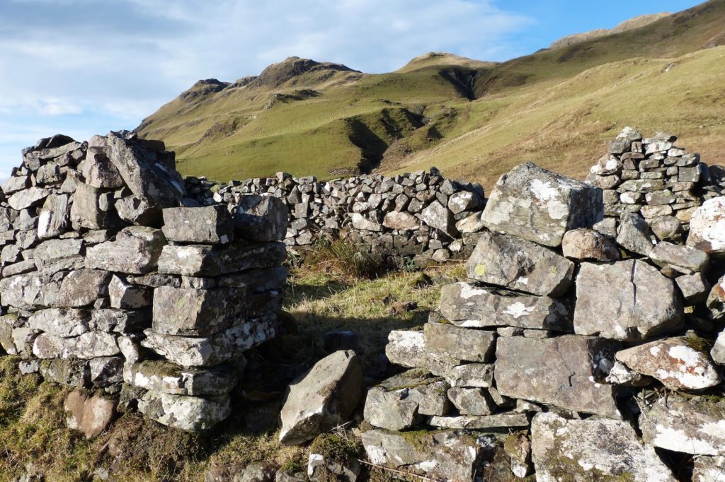
The remains of the houses are likely to be 18th to 19th century construction. Other structures may include a kiln-barn, byres and other storage barns. The houses were substantially built, had rounded corners, and were probably cruck-framed and hip-roofed.
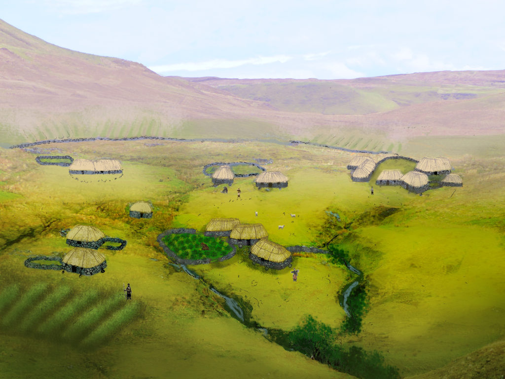
From the previous photograph it is possible to reconstruct what Bourblaige may have looked like in the years just before it was cleared – sketch by Rachael Kidd.
But the settlement is likely to be much older and there is evidence of older buildings in and around the post medieval village. The author, MEM Donaldson, who lived for many years at Sanna, considered Bourblaige to be the site of Muribulg, where the ‘Annals of Tigernach’ record a battle between the Picts and Dalriads in 731AD.
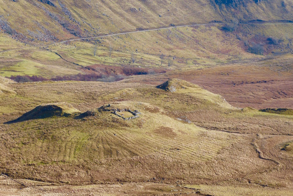
There appears to have been Iron Age activity too. To the northwest of the settlement’s site is this conical hill. Its flanks have evidence of the intensity of farming activities, and, near the summit, there are the remains of a pre-clearance sheep fank, but the area is also recorded as a hill fort, and a further fort lies nearby to the east.
For more information, take a look at the Bourblaige Local Guide